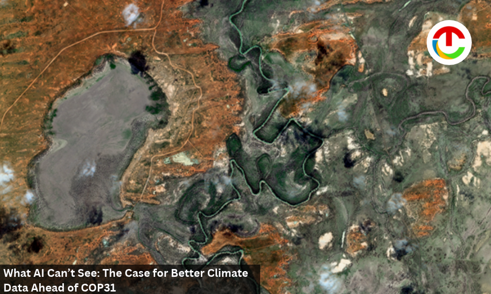
The Darling River winds through the dry floodplain at Kinchega National Park, New South Wales, Australia. River red gums trace its bends, contrasting with the surrounding dunes and claypans. Captured by the EarthDaily Constellation on August 15, 2026.
When AI fills gaps in climate observations, decision-makers need to know where measurements end and estimates begin.
By Don Osborne
Countries heading to COP31 in Antalya have a difficult task ahead: showing whether their efforts to adapt to climate change are making a difference. They now have 59 Belém Adaptation Indicators adopted at COP30 to help track that progress. The second Global Stocktake, which will assess collective progress under the Paris Agreement, also begins its information-gathering phase at the summit, running November 9–20.
AI will be part of the conversation. The COP31 presidency’s Antalya Pledge on AI addresses the technology’s energy use and responsible deployment. But there is another question worth bringing to Antalya: can the climate evidence produced with AI be trusted?
Satellite observations help show how conditions are changing on the ground. When those observations have gaps, AI can help fill them, and the resulting record may look complete. But there’s a question worth asking plainly: which parts of that record were actually observed, and which were estimated?
Monitoring a cast-changing planet
Some of the most damaging changes on the ground move faster than most satellites can keep up with. If the next satellite pass comes too late, it may miss the period when the most important change took place.
Many regions on Earth are not observed every day at a resolution that can track changes in crops, forests or infrastructure. Cloud cover can extend the gap between usable optical observations to two weeks or longer. Persistent cloud can still close the window entirely. That’s part of why optical coverage rarely works alone; it pairs best with radar and ground-based data filling in where it can’t. Wheat, for instance, is especially vulnerable during flowering or grain filling. A heat wave lasting just a few days at that stage can cut into the eventual yield. Miss that window, and the timeline disappears too: when the stress started, how it built, the detail that makes an early warning possible.
Infrastructure and land monitoring run into a version of this too. Most satellite tasking still assumes someone already knows where to point the camera. That’s fine when you are after a known target, say a building named in an intelligence report. It works less well for a wildfire risk building for months along a power line nobody is scheduled to inspect, or illegal logging creeping into a forest block no one has flagged. Systematic, broad-area coverage doesn’t eliminate the need for tasking, but it gives that targeted coverage something to respond to: a record showing where change is actually happening, rather than a guess about where to point next.
What happens when AI fills in the blanks?
Where COP31 the observational record falls short, AI is increasingly used to fill it, and it’s good enough at the job that the seam disappears. Say a burned hillside sits under cloud for three weeks, right in the stretch when new growth would first appear across the slope. Once the clouds clear, a model can use measurements from before and after the gap, along with data from comparable sites nearby, to estimate what happened in between. On a recovery curve, those estimated points may appear alongside observations with no visible break, the kind of record that could end up feeding a forestry assessment or an adaptation indicator.
Unless the reconstructed points are marked, the curve alone may not show which values came from a sensor and which were estimated. A modeled value can appear just as precise as an observation, even though the uncertainty behind each may be different. Reconstruction is useful when that distinction and its uncertainty are clear. If they are lost in the final report, a policymaker, insurer or funder may not know how much confidence to place in the result.
AI needs more than clean training data
Knowing which values were estimated is only part of the challenge. The observations used by a model also need to be consistent, both when it is trained and when it is put to work. Even a model trained on a well-calibrated archive can run into trouble once it’s live. If differences in the incoming data come from the sensors or the conditions under which they collected it, rather than from changes on the ground, those differences add noise to the record. A model looking for signs of crop stress or forest damage may interpret that noise as change, or miss a real change hidden within it.
This challenge can become especially apparent when an EO pilot moves into operational use. A pilot may run on a curated dataset and a pipeline built for a specific demonstration. Scaling it means working with new data, across more places and over longer periods, while maintaining the same level of consistency.
It’s also why calibration and validation have to run continuously, not as a one-time setup step. Every observation of the same place needs to produce a comparable, calibrated measurement, pass after pass, whether it’s the data a model trained on or the data it’s reading in production.
The standard COP31 should set
A year ago, ahead of COP31, the case being made across this industry was thatreliable measurement is the foundation of climate accountability. That case still holds, and the stakes have gotten more concrete. I see the Belém Adaptation Indicators, the start of the second Global Stocktake and the Antalya Pledge on AI as pointing toward the same opportunity: evidence that holds up under scrutiny, supported by AI-assisted analysis. That’s worth turning into an actual standard.
A climate report should make clear whether a figure is based on a satellite observation or a modeled estimate. It should also identify the source, the processing applied and the uncertainty associated with the result. The calibration and validation behind each number should hold up to a second look as well. The system also needs to be tested under extreme conditions, when the consequences of getting it wrong are greatest.
Good inputs are where this starts; they don’t finish the job on their own. That’s the standard I think this industry should hold itself to, at COP31 and every season after.
Also Read :- The 10 Most Trusted Snowflake Partner To Watch in 2026